favicongohere

Please use the navigation menu at bottom the Page
MenuGoHere

Early History of Reist Mill at Amherst State Park
1866 Reist Mill Structures
-
1.The Reist Mill
-
2.John Reist Home
-
3.Saw Mill
-
4.Abraham Long Home
-
5.Old Forge Dam
-
6.Greybiel Forge
-
7.Mill Pond
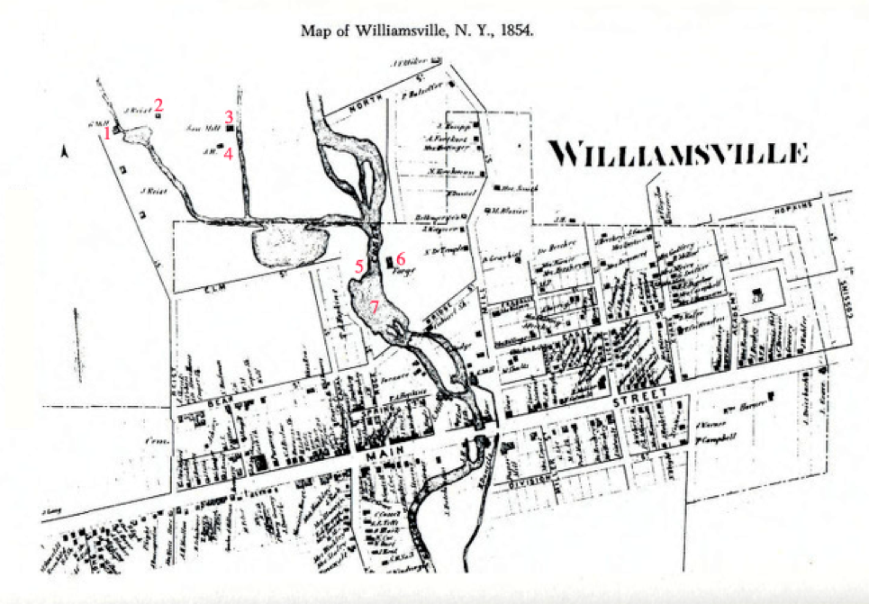

The map of the Village of Williamsville, 1866, shows some of the changes a century makes.
Most of the streets remain in their original location and names; Canal Street became North Cayuga, Bear Street and Bridge Street combined to make Glen Avenue, Cossins Street became Rinewalt, Miller became Oakgrove Drive, and Division became Park. Hopkins Street no longer exists, nor does Hershey Street. Elm, North and Forge Streets were absorbed in the development of the Sisters of St. Francis purchase.
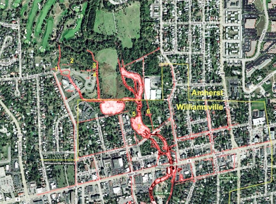
The aerial picture below is overlaid with the 1866 map of the Village of Williamsville. This shows the location of the Reist Mill structures of 1854 and where they would have existed in Amherst State Park.


All Rights Reserved


AmherstStatePark.org
AMCNT Web Design Copyright 2011-14 ©
All Rights Reserved